Mapping the intrinsic potential of water infiltration in urban subsurface: feedback from France

All claims expressed in this article are solely those of the authors and do not necessarily represent those of their affiliated organizations, or those of the publisher, the editors and the reviewers. Any product that may be evaluated in this article or claim that may be made by its manufacturer is not guaranteed or endorsed by the publisher.
Accepted: 2 August 2024
Authors
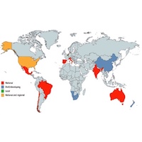
In a context of increasing urbanization, with strong soil sealing, and with an increase in extreme weather events, the management of rainwater in urban areas is becoming a major issue. In order to improve water resource management and to prevent urban floods, more and more cities are considering or already implementing water infiltration systems. Infiltration of water is not possible anywhere due to natural and/or anthropic reasons. In this frame, the intrinsic infiltration capacity of the subsurface is one key natural parameter. Global maps are needed to build territorial strategies. In France, a lot of studies are available but a national methodological framework for mapping this index does not exist. In this paper, we analyse various studies carried out in France for such mapping and compare the methods with examples in other countries. Most of the French studies combine a Multi-Criteria Analysis (MCA) and a Geographic Information System (GIS) spatial analysis. The criteria include geological, hydrogeological and geomorphological parameters. The PHOEBUS method developed on Rennes Metropolis seems the most relevant and replicable one to provide a common framework at French scale. It takes into account 7 criteria, including rock/soil permeability, topographic slope and thickness of the unsaturated zone. The obtained maps may be used as such, modified by integrating sealed surfaces or crossed with other criteria linked to the urban environment (e.g. sealed surfaces, soil pollution, heat islands). They provide a decision support tool for urban planning. In particular, they are useful to improve rainwater management, but also in the elaboration of desealing or renaturation strategies. It seems essential to act in concertation with local stakeholders to identify their needs and the specificities of the territory.
Downloads
Citations


Supporting Agencies
ADEME (French Environmental Agency), Rennes Metropolis, SABOMHow to Cite

This work is licensed under a Creative Commons Attribution-NonCommercial 4.0 International License.