Investigating the feasibility of using precipitation measurements from weather RaDAR to estimate potential recharge in regional aquifers: the Majella massif case study in Central Italy
All claims expressed in this article are solely those of the authors and do not necessarily represent those of their affiliated organizations, or those of the publisher, the editors and the reviewers. Any product that may be evaluated in this article or claim that may be made by its manufacturer is not guaranteed or endorsed by the publisher.
Accepted: 26 September 2022
Authors
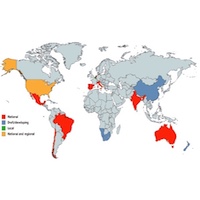
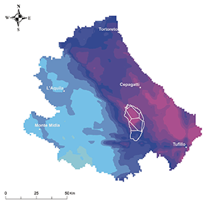
Rain gauge spatial sparsity and temporal discontinuity of data represent one of the major issues for reliable recharge estimations. In the past decades, the use of ground-based microwave weather RaDAR has dramatically improved quantitative rainfall estimation by providing spatially continuous estimates of rainfall over an area of more than 400 km2 every 10 minutes. Furthermore, weather RaDAR data have also proved relatively reliable in mountainous areas. These paramount features of RaDAR-derived precipitation data could improve the estimation of potential recharge of aquifers, which rely on geospatializations (e.g., Thiessen polygons) of rainfall data collected by a sparse rain gauge network which often shows lacking at high altitude (i.e., recharge areas), introducing additional uncertainty in the inflow volumes. Weather RaDAR rainfall estimation is also affected by various sources of error, which can be reduced by proper post-processing; however, uncertainties remain, especially for surface rain rate estimations. Despite the currently necessary complex numerical processing, the purpose of the study is to evaluate the use of the weather RaDAR data as an alternative or in addition to meteorological data. Based on the above considerations, the feasibility of using RaDAR-based precipitation data to estimate aquifer potential recharge and calculate a detailed water budget in the areas characterized by high elevations, such as the Majella massif in the central Apennines, has been evaluated. To address this objective, the water budget has been calculated in the 2017-2018 period using both RaDAR-based precipitation data and rain gauge data, as well as adopting different methods (i.e., Turc and Thornthwaite). Although intrinsically uncertain, the RaDAR-based precipitation data provided solid results, pointed out by comparing it with water budget obtained by rain gauge data, and especially with experimental literature data. This interdisciplinary work may pave the way for continuous monitoring of aquifer potential recharge at extremely high temporal and spatial resolution.
Downloads
Citations


How to Cite

This work is licensed under a Creative Commons Attribution-NonCommercial 4.0 International License.